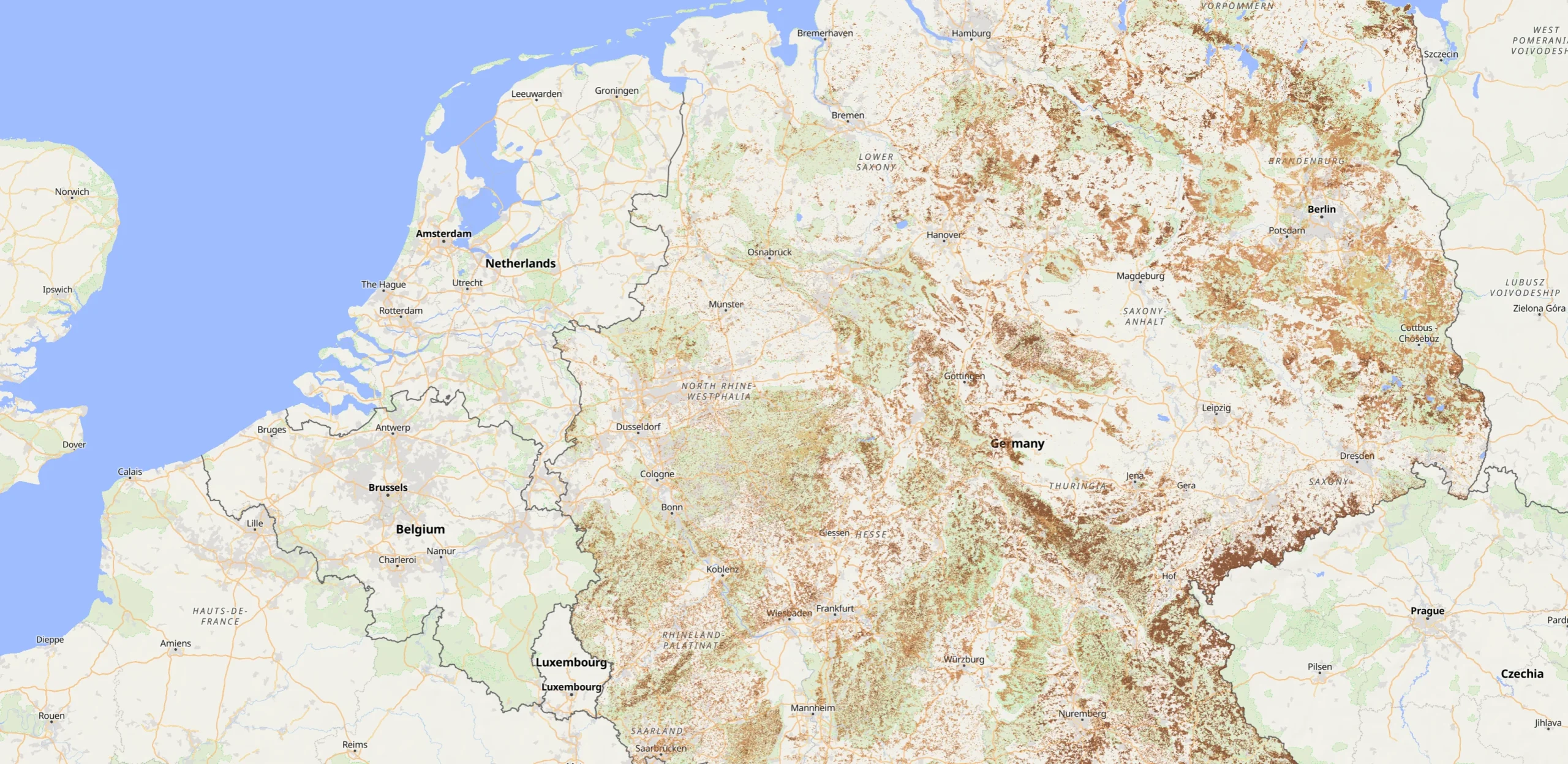
Explore potential mushroom habitats and discover recorded mushroom observations across Germany.
The MushroomID Habitat Map combines satellite-based forest data, soil characteristics, and real mushroom observations to help you explore where different mushroom species may grow.
Unlike traditional mushroom distribution maps, which primarily show where mushrooms have already been recorded, MushroomID also highlights forests with environmental conditions potentially suitable for specific species.
How the Map Works
The map combines several sources of environmental information:
- Tree species: Satellite-derived forest classification from the German Aerospace Center (DLR), identifying pine, spruce, beech, oak, birch, and other trees.
- Soil characteristics: Data from ISRIC SoilGrids, including soil pH, sand and clay content, and organic carbon.
- Habitat suitability: An experimental model that evaluates tree associations and soil conditions to identify potentially suitable areas.
- Recorded observations: Georeferenced mushroom records from GBIF and iNaturalist, displayed as points on the map.
Habitat areas are classified into three relative suitability levels: Lower, Moderate, and Higher. These categories represent the model’s assessment of environmental conditions, not the probability of finding mushrooms at a particular location.
Mushroom Species
The current map covers six species:
- Porcini (Boletus edulis)
- Pine Bolete (Boletus pinophilus)
- Bay Bolete (Imleria badia)
- Birch Bolete (Leccinum scabrum)
- Chanterelle (Cantharellus cibarius)
- Slippery Jack (Suillus luteus)
Select a species to explore its potential habitats and known observations throughout Germany.
Real Mushroom Observations
In addition to predicted habitats, the map displays 4,419 mushroom observation records from two biodiversity data sources, following our initial import and filtering.
GBIF — Global Biodiversity Information Facility
GBIF provides access to biodiversity records contributed by museums, research institutions, citizen science projects, and other organizations worldwide. These records help document the geographic distribution of mushroom species.
iNaturalist is a global community where naturalists share photographs and observations of wildlife, including fungi. MushroomID incorporates additional research-grade observations with suitable publicly available coordinates and reuse permissions.
The current dataset combines 4,120 previously selected GBIF records with 299 additional iNaturalist records that were not identified as duplicates during import.
Black markers represent recorded observations. Click a marker to explore the available observation details. Records can also be filtered by observation year.
Observations and predicted habitats are independent layers. A mushroom may have been recorded outside a highlighted habitat, and a highlighted area does not necessarily contain mushrooms.
Data Sources and Methodology
The map uses the following datasets and platforms:
- DLR — Tree Species Germany 2022: satellite-based tree species classification with 10-metre spatial resolution.
- ISRIC SoilGrids: global predicted soil properties at approximately 250-metre resolution.
- GBIF: georeferenced biodiversity observations.
- iNaturalist: community observations and species identifications.
The habitat prediction model is experimental and has not been independently validated as a reliable predictor of mushroom occurrence. Its results should be used for geographical exploration and environmental interpretation rather than as confirmation that mushrooms are present.
Observation coverage is uneven. Some regions have substantially more records because they are visited more frequently or have more active contributors. Coordinates may also have varying degrees of precision.
Important Information
Mushroom growth depends on many factors beyond tree species and soil conditions, including recent rainfall, temperature, seasonality, and local ecological conditions.
Never use the map to determine whether a mushroom is edible. Identification and edibility must be assessed separately, and wild mushrooms should never be consumed solely on the basis of an automated identification.
Please respect protected areas, local foraging regulations, private property, and sensitive habitats when exploring forests.
The MushroomID Habitat Map is an experimental geographic exploration tool developed by MushroomID.
Upload a photo and get possible matches in seconds.